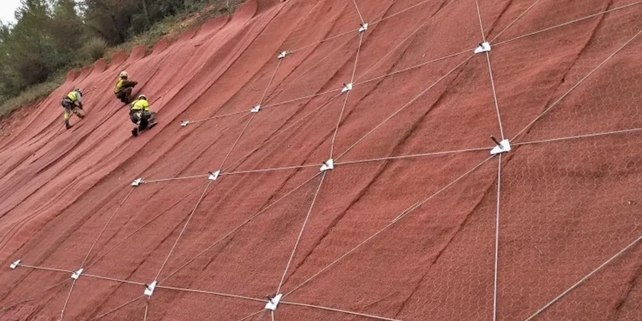
A track-mounted CPT rig or a hollow-stem auger drill is often the first piece of equipment deployed on a San Bernardino hillside, where the transition from the flat valley floor to the San Bernardino Mountains creates inherently unstable transitional slopes. These machines push through layers of weathered Mesozoic granitic rock and young alluvial fan deposits to retrieve the subsurface data that feeds a rigorous slope stability analysis. In a city where elevation rises from roughly 1,000 feet at the Santa Ana River to over 3,000 feet in the foothill neighborhoods within just a few miles, the geotechnical contrast is extreme. The analysis integrates shear strength parameters from laboratory testing with piezometric monitoring to model the factor of safety under both static and seismic conditions. For projects in the Verdemont or North Park areas, where cut slopes expose friable decomposed granite, we often combine the investigation with test pits to visually map joint orientations and seepage patterns before numerical modeling begins.
In San Bernardino foothills, the difference between a stable 1.5 factor of safety and a failing 1.1 often lies in correctly modeling the transient pore pressure spike during the first heavy rain after a drought cycle.
Site-specific factors
San Bernardino sits within a complex seismic zone where the San Jacinto fault splays just 3 kilometers northeast of downtown, and the larger San Andreas fault lies roughly 15 kilometers to the northeast. A magnitude 7.0+ event on either structure would subject hillside developments to peak ground accelerations exceeding 0.4g, a level at which pseudostatic slope stability analysis becomes essential rather than optional. The 1812 Wrightwood earthquake on the San Andreas produced shaking intensities estimated at MMI VIII across the San Bernardino Valley, and paleoseismic trenching reveals multiple Holocene ruptures. For slopes in the Verdemont and Shandin Hills areas, where decomposed granite mantles steep bedrock surfaces, the combination of seismic shaking and elevated pore pressures could trigger flow failures similar to those documented in the 1971 San Fernando event. Our analysis explicitly models post-earthquake strength reduction using undrained residual strengths from ring shear testing, and evaluates deformation potential through Newmark sliding block analysis when the calculated pseudostatic factor of safety falls below 1.0. These results directly inform retaining wall design parameters and setback requirements from the slope crest.
Questions and answers
What triggers a slope stability review by the City of San Bernardino?
The City requires a geotechnical report with slope stability analysis for any grading on slopes steeper than 15 percent, any cut or fill exceeding five feet in height, and any structure proposed within the Alquist-Priolo Earthquake Fault Zone or a mapped potentially liquefiable area. The analysis must demonstrate minimum factors of safety per the current California Building Code and IBC, and must address both construction-phase and long-term conditions.
How much does a slope stability analysis cost in San Bernardino?
The cost for a slope stability analysis in San Bernardino typically ranges from US$1,230 for a straightforward evaluation of a single-family residential lot with existing subsurface data, to US$4,050 for a comprehensive analysis of a larger hillside development requiring new drilling, laboratory strength testing, and seismic deformation analysis. The final scope depends on slope height, geological complexity, and proximity to active faults.
Which failure modes are most critical for San Bernardino slopes?
The dominant failure modes in the San Bernardino area are shallow translational slides within the colluvial mantle during heavy rainfall, and deep-seated rotational failures along the weathered bedrock contact when pore pressures build within the decomposed granite. Seismically-induced block sliding along joint-controlled planes in the granitic rock is a third critical mechanism, particularly north of the 210 freeway where the San Jacinto fault proximity increases the design ground motion.