During the preliminary grading for a commercial project off Hospitality Lane, the contractor hit unexpected groundwater in what the geological maps showed as dry alluvium. The site sat on a buried channel of the Santa Ana River, invisible from the surface. In a basin like San Bernardino, where Pleistocene alluvial fans interlock with fine-grained playa deposits from the old Lake Manix system, the subsurface is never as uniform as the flat terrain suggests. Seismic tomography—both refraction and reflection—gives us a continuous velocity profile that reveals these hidden transitions. By measuring P-wave and S-wave travel times from an array of geophones, we map bedrock depth, detect fracture zones, and assess rippability without a single borehole. For engineers working under the City of San Bernardino’s geologic hazard review, the method provides the lateral coverage that a standard test pit or discrete boring simply cannot offer. When the project sits within the liquefaction susceptibility zone of the Upper Santa Ana Valley, we often pair the tomography data with a site-specific liquefaction analysis to satisfy the California Geological Survey’s Seismic Hazard Mapping Act requirements.
A well-executed refraction survey in San Bernardino’s alluvial basin can distinguish compacted fanglomerate from weathered granite wash at 80 feet depth—a distinction that changes the foundation type from spread footings to drilled piers.
Site-specific factors
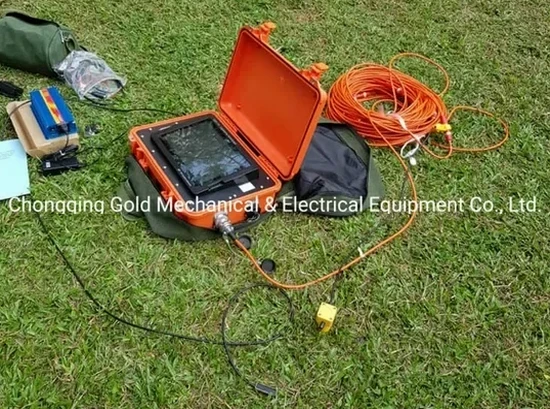
The geophone cable runs 575 feet across a graded pad in San Bernardino at 105°F in August. The PVC jacket softens just enough that the connector pins start wobbling, and a single loose channel means re-shooting the entire spread. Our crew carries spare cables and keeps the seismograph under a reflective tarp—lessons learned from summers where asphalt temperatures exceed 140°F. Beyond the equipment headaches, the biggest interpretative risk is misidentifying a groundwater-refraction crossover as bedrock. In the San Bernardino basin, the water table can rise seasonally within 10 feet of the surface, creating a high-velocity layer that masks deeper structure. We run reciprocal shots from both ends of the spread to verify the velocity model and cross-check against any available water well logs from the San Bernardino Valley Municipal Water District’s database. When the tomography profile crosses a suspected trace of the San Jacinto fault zone, we tighten the geophone spacing to 5 feet and extend the recording time to capture low-frequency S-wave arrivals that help delineate the fault gouge.
Reference standards
ASTM D5777-18 (Standard Guide for Using the Seismic Refraction Method for Subsurface Investigation), ASCE 7-22 (Minimum Design Loads and Associated Criteria for Buildings and Other Structures, Seismic provisions), 2022 California Building Code, Chapter 16 (Structural Design, incorporating IBC seismic hazard criteria), California Geological Survey Seismic Hazard Mapping Act (PRC 2690–2699.6), liquefaction and ground shaking zones, ASTM D7400-19 (Standard Test Methods for Downhole Seismic Testing, applicable for cross-verification)
Questions and answers
What is the approximate cost of a seismic refraction survey for a typical commercial lot in San Bernardino?
For a standard commercial project requiring 3 to 5 refraction lines with a total spread length of 600–1,200 feet, the field acquisition, processing, and reporting usually falls between US$2.870 and US$5.810. The final number depends on the number of spreads, the source type (sledgehammer versus weight drop), and whether S-wave acquisition is needed for Vs30 site classification. Sites with difficult access—steep terrain near the foothills or active construction zones—may require additional layout time that affects the mobilization cost. We provide a fixed-price proposal after reviewing the site plan and the depth of investigation your geotechnical engineer requires.
How deep can seismic refraction and reflection see in the San Bernardino basin sediments?
Refraction with a 575-foot spread and a sledgehammer source typically resolves to 100–150 feet in the dry alluvium and fanglomerate deposits common across San Bernardino. Reflection surveys using an accelerated weight drop can image to 300–400 feet, enough to map the contact between Quaternary basin fill and the underlying crystalline basement of the Perris Block. The actual depth penetration depends on the velocity structure and ambient noise—working near the BNSF rail yard or the I-215 freeway requires nighttime acquisition to reduce traffic vibration.
Can seismic tomography detect faults on my property before we build?
Seismic reflection and high-resolution refraction can identify velocity discontinuities, offset reflectors, and disturbed zones consistent with faulting. In San Bernardino, where the San Jacinto and San Andreas fault systems create a complex network of splays, the method helps map the approximate trace and width of fault zones. However, seismic tomography alone does not satisfy the Alquist-Priolo Act requirements for fault setback determinations—that requires exploratory trenches logged by a California Professional Geologist. We coordinate with the trenching contractor so the tomography data guides the trench location, reducing the number of linear feet excavated.